


The paths of all solar eclipses are tabulated sequentially, by decade and year.
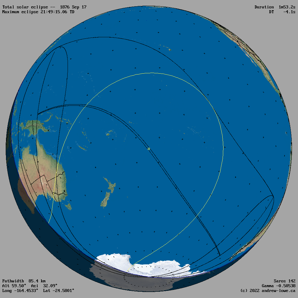
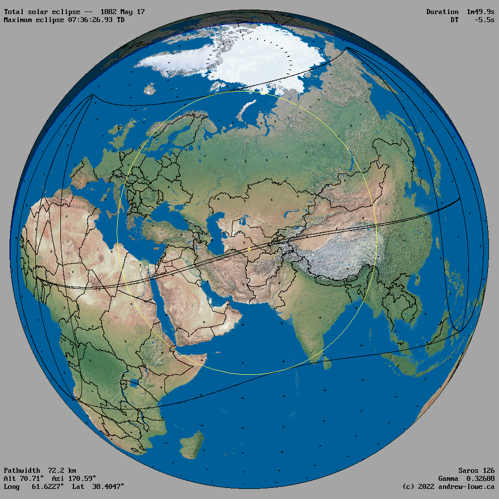
The outline of the umbra (total or annular eclipse) and the penumbra (partial eclipse) are shown for the moment of maximum eclipse.
Click on an image to view its uncompressed version.
Solar Eclipse Maps 1700 to 1799 1900 to 1999
1800s
|
| 1800 |
|
|
| 1801 |
|
|
|
|
|
| 1802 |

|

|
| 1803 |

|

|
|
| 1804 |

|

|
| 1805 |

|

|

|

|

|
|
| 1806 |

|

|
| 1807 |

|

|
|
| 1808 |

|

|

|
| 1809 |

|

|
1810s
|
| 1810 |

|

|
| 1811 |

|

|
|
| 1812 |

|

|

|

|
| 1813 |

|

|
|
| 1814 |

|

|
| 1815 |

|

|

|
|
| 1816 |

|

|
| 1817 |

|

|
|
| 1818 |

|

|
| 1819 |

|

|

|

|
1820s
|
| 1820 |

|

|
| 1821 |

|

|
|
| 1822 |

|

|
| 1823 |

|

|

|

|
|
| 1824 |

|

|

|
| 1825 |

|

|
|
| 1826 |

|

|

|
| 1827 |

|

|
|
| 1828 |

|

|
| 1829 |

|

|
1830s
|
| 1830 |

|

|

|

|
| 1831 |

|

|
|
| 1832 |

|

|
| 1833 |

|

|
|
| 1834 |

|

|

|
| 1835 |

|

|
|
| 1836 |

|

|
| 1837 |

|

|

|
|
| 1838 |

|

|
| 1839 |

|

|
1840s
|
| 1840 |

|

|
| 1841 |

|

|

|

|
|
| 1842 |

|

|

|
| 1843 |

|

|
|
| 1844 |

|

|

|
| 1845 |

|

|
|
| 1846 |

|

|
| 1847 |

|

|
|
| 1848 |

|

|

|

|
| 1849 |

|

|
1850s
|
| 1850 |

|

|
| 1851 |

|

|
|
| 1852 |

|

|

|
| 1853 |

|

|
|
| 1854 |

|

|
| 1855 |

|

|
|
| 1856 |

|

|
| 1857 |

|

|
|
| 1858 |

|

|
| 1859 |

|

|

|

|
1860s
|
| 1860 |

|

|
| 1861 |

|

|

|
|
| 1862 |

|

|

|
| 1863 |

|

|
|
| 1864 |

|

|
| 1865 |

|

|
|
| 1866 |

|

|

|
| 1867 |

|

|
|
| 1868 |

|

|
| 1869 |

|

|
1870s
|
| 1870 |

|

|

|

|
| 1871 |

|

|
|
| 1872 |

|

|
| 1873 |

|

|
|
| 1874 |

|

|
| 1875 |

|

|
|
| 1876 |

|
|
| 1877 |

|

|

|
|
| 1878 |

|

|
| 1879 |

|

|
1880s
|
| 1880 |

|

|

|

|
| 1881 |

|

|
|
| 1882 |
|

|
| 1883 |

|

|
|
| 1884 |

|

|

|
| 1885 |

|

|
|
| 1886 |

|

|
| 1887 |

|

|
|
| 1888 |

|

|

|
| 1889 |

|

|

|
1890s
|
| 1890 |

|

|
| 1891 |

|

|
|
| 1892 |

|

|
| 1893 |

|

|
|
| 1894 |

|

|
| 1895 |

|

|

|
|
| 1896 |

|

|
| 1897 |

|

|
|
| 1898 |

|

|

|
| 1899 |

|

|

|
Solar Eclipse Maps 1700 to 1799 1900 to 1999